Monday, 22 September 2025

Assessing the effects on Kentish landscape of the Roman withdrawal

 The effects of the Roman withdrawal from Britain in 410CE and of the arrival of Germanic peoples a few decades later have long been debated. 

Did the economy and the rule of law collapse or did remaining Romano-Britons continue much as before?

Did the Saxons (and Angles and Jutes) arrive as warriors, clearing out the Britons towards the west and north and taking over their lands to be settled by their kinfolk, or did the new arrivals assimilate with the native population (albeit in a dominant role). Were the remaining Britons enslaved?

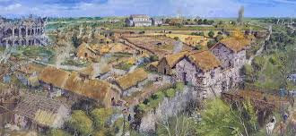
Canterbury Museum has an excellent series of model tableaux indicating the grandeur of the city under Roman occupation with forum, amphitheatre, theatre and so on, and of that city in ruins some time later. 


Bede describes a genocide and was influential for many centuries, while others (more recently) have argued for more integration.

Alan Everitt in Continuity and Colonization Evolution of Kentish Settlement uses locations and place-names to try to tease out an answer (Lambarde in the late c16 also used his interest in Anglo-Saxon language to seek evidence) but there is clearly a need for new methods of investigation.

KCC paper in 2013 recommended such a fresh approach to the Romano-British/Anglo-Saxon transition, and a project which concluded with The Fields of Britannia by Stephen Rippon analyses a different set of data, using "a regional approach to studying landscape", using:

  • pollen samples 
  • field systems and
  • landscape development.
Pollen data is analysed by region, to provide changes in the proportion of plant types in the landscape during and just after the Roman occupation. An increase in tree pollen and a reduction of pasture and arable plant pollen would indicate a loss of farming activity:

For the south east region (admittedly a large and varied area) there was indeed a change in this direction, with the greatest change of all the regions:

Woodland pollen increased by 5-6%, and unimproved pasture pollen by 3-8%, whereas arable pollen fell by 1-2% and improved pasture pollens by 8-11%.  This could support a theory of discontinuity but as the author points out this could just reflect the reduced need for supplies for the Roman empire.

Animal bones and crop residues give more clues to agrarian changes; beef gave way to sheep and goats, and wheat was eclipsed by barley, rye and oats, reducing the trade in goods most needed by the Roman market-based economy in favour of local self-sufficiency.

Landscape development 

In a very difficult area of study, the project concludes that 50-60% of pre-Saxon field patterns remain visible today, and that since woodland regenerates to a level that obscures previous boundaries within 30 or so years (questionable?) that - and the pollen evidence summarised above - supports the view that there was not a significant abandonment of agriculture after the Roman withdrawal, but a reduction in its efficiency and yield.

However, the issue of population should be considered; the estimate for England is 4m during the Roman occupation based on the amount of land used, but only c1.5-2.2m at the time of Domesday, a significant fall. A number of points arise from this comparison:

  • is the method of estimate appropriate?
  • if so, is the fall due to mercantile and urban population loss, leaving the countryside at a similar level;
  • was there a significant reduction in food production efficiency (in line with lower demand) but similar settlement sizes for this reduction?
  • was there only a small number of Germanic invaders (conquerors not settlers) who drove the unproductive (urban) population to the west?

Conclusions of the project

The overall conclusion of The Fields of Britannia project is that the money-based market economy did indeed collapse leading to more subsistence-based agriculture, while higher-status (and effectively less economically-useful) parts of the population would have been most affected. Towns and villas became unimportant and so were depopulated.

This principle is continued by Fiona Fleming who analysed settlements in north Kent during and after the Roman withdrawal and found relatively little continuity, with even lower status settlements persisting in only 20% of cases studied.

The Saxon migrants settled (at first at least) in the most favoured areas, not where the Romano-British had been based. In Kent, lands near the north and east coast and rivers were easily accessible, defendable and productive, so early settlements near Eastry, Mongeham, Thanet, the Medway and the Darenth were quickly populated.


Applying this conclusion to our local area

Landscape development is a tantilising subject for local field-walkers, who (if you're like me) "see to much". It is especially interesting when you have a Roman road system on your doorstep, and so try to apply local structures like field boundaries, chapels and churches, villages and water courses to the road. 

As Paul Harvey and John Blair observe in the context of local historical studies, a map is the best possible antidote to scholars’ often subconscious tendency to focus on what is there to be studied, and to airbrush out the gaps in knowledge: "The map will have none of this. It gives equal emphasis to every part of the whole and there can be no sliding over doubtful points. … Faced with the questions posed by any reconstruction on a map one realizes just how imprecise one’s knowledge is, how many gaps there are that on the map will have to be represented by blank spaces or the most hesitant of outlines."

Two local sites illustrate this theme, one from Romano-British time and one after the withdrawal.

Beside the Roman road running north from Dover towards Richborough there is a very clear settlement outlined by cropmarks (the 2007 aerial photography is particularly good), which A.E. Johnson who  investigated this area and published papers in 1999 and 2000, concluded represent "a series of conjoined and relatively well organised enclosures of probable later prehistoric or Romano-British date".  There appears to be no evidence of later use, despite the close proximity of the road which remains in use up to modern times.


In contrast, apparently from later date, between Ripple and Mongeham on Beacon Hill there are crop marks showing the locations of an early chapel (left, below) and a large burial ground (right) which seem to be early Saxon.


These are well away from the current village of Great Mongeham with its church dated from Norman times, although incorporated into its fabric are many pieces of Roman brick; was there a Christian church on the current site when the Saxons arrived, and they relocated the cemetery to Beacon Hill, and then moved back to the village on reconversion? 

There needs to be an archaeological study on the Beacon Hill site to determine the dates of occupation (was it occupied before Saxon times?)

Excavation of a cemetery north of Sangrado's Wood (Updown, near Eastry) found 77 graves with at least 20 encircling ditches, dating from the second half of the 7th century and possibly associated with the royal villa at Eastry.  Grave goods were absent or modest but included spears, knives, beads, latch lifters, shears, bangles, pins etc plus pottery and glass vessels - on the cusp of conversion to Christianity?


John Blair in The British Culture of Anglo-Saxon Settlement writes

"Kent is one of the unlikeliest places to be considered marginal in a conventional view of Anglo-Saxon England. Why, with such spectacularly rich cemeteries and minsters, such an abundance of metal small-finds, and the opulent sixth- to seventh-century aristocratic culture now displayed at Lyminge, is ordinary rural settlement so elusive? A continuing British — and thus invisible — domestic tradition is perhaps not quite so implausible as it might seem, given the unusually persuasive hints of a British ecclesiastical tradition in late sixth-century Kent."


Eastry's settlement is especially elusive.


On Kingsdown Tumuli

 Cumberland H Woodruff excavated a bowl barrow on the Freedown in the parish of Ringwould in 1872.

The KCC Heritage map site shows the location:

Regretably the post-war changes to agricultural practices (and probably the recent loss of rabbits) have allowed the area surrounding the bowl barrows to be scrubbed up and so they are no longer visible from a distance. A badger sett has taken over the northern one, further distorting what is left of the original shape.

A trackway that passed close to the barrows has been lost to ploughing although the straight track south-west from Victoria Road remains. 

The Swing Riots - 1830

 The short period of unrest in southern England in the autumn of 1830 became known as the Swing Riots, after the name used in some letters to landowners and farmers, signed "Captain Swing".

The apparent cause of the riots was the threat posed to winter working by the introduction of threshing machines, which could thresh corn more quickly (and presumably more cheaply) than manual labour. As the labouring poor were suffering harsh poverty in this period after the Napoleonic War, the threat to their lifeline in winter was real.


As context, around the events of 1830 were:

1773 - Inclosure Act took away rights of peasants to graze and otherwise use the countryside "wastes" although this had little impact in south-eastern England.

1790-1815 - Napoleonic disruption to grain imports raised prices

1815 - Waterloo effectively ends the Napoleonic War, resulting in demobilisation of large numbers of soldiers into an already full rural labour market.

Lord Liverpool passed the Corn Laws to keep prices artificially high.

1820 - Poor Law Amendment Act passed, providing a top-up to minimum wages. This allowed farmers to pay low wages as the parish paid a subsidy. Although workhouses were not formalised until 1834, these were already being built to accommodate the poorest.

1828,1829,1830 - three wet summers, and 1829/30 was a cold winter.

1830 - 16th November - Duke of Wellington was replaced by Earl Charles Grey as Prime Minister.

1832 - Great Reform Act

1832 - Allotments Act

1834 -  Poor Law Amendment Act

1834 - Tolpuddle "martyrs"

1836 - Tithe Commutation Act

1838 - George Courtenay's "army" defeated in the Battle of Bossenden Wood

It has been generally accepted that the first attack on threshing machines was in Lower Hardres on 28th August 1830, but this has been challenged after work done by the Elham Historical Society showed that there was an earlier event, on the 24th, at Wingmore in the Elham Valley. 

There were 13 attacks in the area in the next few weeks, while the unrest spread (or perhaps occurred spontaneously) elsewhere in southern England; west Kent, Sussex and across Hampshire, Wiltshire and Dorset were all affected.

In total, 154 events including arson, wage riots as well as machine-breaking were attributed to this outbreak in Kent, and 1475 in England.

Punishments were initially lenient (Sir Edward Knatchbull was criticised for his clemency) but most were harsh. Of 102 accusations in Kent, 4 were executed, 48 imprisoned and 25 transported to Australia, mostly to Van Dieman's Land. The equivalent figures for England were 1952 accused, 19 executed, 644 jailed and 491 transported.

In one of the enquiries, the Rev. Tho. D'Usoe stated that the rioters were "like Worzel-snouts" in their actions.

William Cobbett wrote of his sympathies for the rioters and was tried but acquitted for complicity.

As a result of the Riots, some wages were increased slightly, and some attempts were made to improve rural conditions.  Threshing machines mostly went out of use, partly through fear of labourers' reprisals and partly as the surplus of labour reduced their economic benefit.

In evidence to the Poor Law committee, the curate of Westwell said "they say, Ah them there riots and burnings did the poor a terrible deal of good".


https://premium.weatherweb.net/weather-in-history-1800-to-1849-ad/

http://www.ehsdatabase.elham.co.uk/Stories/SwingRiots.pdf

https://research-information.bris.ac.uk/ws/portalfiles/portal/34503575/DX223381.pdf


Tithe Maps and Apportionments

 Tithe maps and their apportionments give a good view of the rural countryside in the 1840s, showing (at best) the ownerships, tenancies, land use and the local names of fields, woods and marshes.

For Kent there are two sources for the apportionment listings - the Kent Archaeological Society and Ted O'Connell's website, but unfortunately for the desk-bound amateur historian the maps can only be viewed in local libraries by asking the librarian for CDs for each parish.


Part of the Tilmanstone Tithe Map, showing the village and Dane Court

Kent Archaeological Society's website for tithe maps includes a good introductory article from Archaeologica Cantiana summarising the reasons, progress and outcomes of the project, which was an impressive achievement. There are also useful maps showing the dates of progress, the teams of surveyors and crop coverage.


Transcription of the 407 parish allocations was carried out by a small team of historians (east Kent mainly by Pat Tritton) and are shown on the KAS site which is downloadable easily into spreadsheets, and on Ted O'Connell's marvellous website.


The recalculated tithe continued to be a controversial charge, and effected Kent as analysed by John Bulaitis in his book The Tithe War 1881-1936.

"John described several disruptions caused by the tithe-payers throughout Kent. The movement of seized goods to commissioners’ farms was stopped and auctions took place at the farm where the tithe was owed. The tithe-payers then fixed the auction to ensure items were sold for much less than their worth. Tithe collectors sent men in to increase the bidding but they were sent packing being pelted by mud whilst others were dunked in cesspits etc. The press had a field day with headlines and reports making the collectors appear fools as the tithe payers outwitted them. In 1934 the Lord Chancellor reported that there were so many unexecuted orders that it was impossible to administer them in a reasonable time.

"In the end the government decided to collect the tithe through the tax system .The government secretly bought the system from the church at three and a half million pounds and managed to cover the sale with an seemingly private agency running it. The Tithe Act of 1936 allowed for the winding down of the tithe tax, to be ceased completely by 1996.  However, due to changes in agriculture when the inland revenue looked at the system in the 1970s, they found that it was costing more to administrate than they were collecting and the tithe was ceased."

Roman Roads and ferries - Richborough

 Richborough was one of the most important towns in Roman Britain for at least the first half of the occupation, as it was the main port for goods and the military movements to and from the continent. They fact that it was virtually undefended for most of its life shows how complete was Roman control of England at the time.

A minor unsolved mystery is which were the routes used for travelling inland from the island of Richborough, surrounded as it was by the wide Wansum Channel to the north and east and by marshes to the west and south. Over the four hundred years of occupation, there were probably a number of routes as conditions changed. Even today, paths around the English Heritage site are muddy and hampered by water-filled ditches.

This map by Floodmap.net has been used to show water levels of 3m higher than today, giving an indication of the landscape in Roman times.

Richborough castle (1) and the amphitheatre (2) are on the east side, with the (as yet unexcavated) town between them. Was there a raised trackway or boardwalk from there to the mainland around Richborough Farm (3) and beyond to roads from Ash (4 & 5), and/or a ferry to East Street (6 with an apparent wharf (7) and Each End (8).  

There was certainly a ferry from Each End to Sandwich in that town's early days - you can see the pub where (like at Grove Ferry and Pluck's Gutter) refreshments could be enjoyed while waiting for the ferryman.

One of the possible (probable?) connecting roads is clearly visible north of Each End, between East Street and Brookstreet Farm, below.


Note the usage of 'street' in the name, denoting a paved road rather than an muddy track so possibly of Roman origin. There are plenty of cobbles in the fields beside the track, contrasting with the usual random flints.


"In 1775, Meſſrs. Dunthorne and Yeoman were appointed to examine the State of the Stour, overlooking the two principal or only Cauſes of its Inundations, and of the Stagnation of the Water"

"...the Slowneſs of the Current does Prejudice to the Harbour of Sandwich, in the Summer Time, by permitting the Sand and Mud, that are carried along with it, to ſubſide more eafily there, and to form ouzy Banks along the Sides of the Channel, by which it is contracted into much narrower Dimenſions, and rendered leſs commodious for Shipping, than it otherwiſe would be; and were it not for the extraordinary Quantity of Water that comes down in Winter, and carries off the collected Mud, Sandwich Harbour would ſoon fill up, ſo as to Be capable only of Boats, or Veſſels of the ſmalleſt Size- But what the Proprietors and Occupiers of the Ground or Levels, on each Side of this River, ſeem moſt concerned for, is its overflowing its Banks in the Winter Time, and thereby laying ſeveral thouſand Acres of good Soil under Water for five or fix Months in the Year, which renders them incapable of proper Culture and Produce the Reſt of the Year, This is undoubtedly à very great Loſs, and ought to be remedied, if it could be done without e to any of chrir Neighbours..."

"It is imprudent.... to try experiments with the natural Cha Is of navigable Rivers; many ſuch have been deſtroyed by raſh and injudicious Attempts. to improve them, or gain ground near them."

"...the moſt obvious and moſt effectual Remedy ſeems to be, when it once becomes dry, to take Care to keep it ſo, by embanking....or making firm Dykes or Walls of Earth, a little from the Margin of the River on each fide".